Mt Harrison, July 13th, 2025 - 3359metres
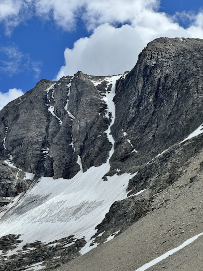
Synopsis: 3.5 stars, The North Couloir is a 50 degree obvious couloir and is a great day out with good conditions. The drive in is a bit of a crux however the approach is somewhat straight forward (thanks I believe to Foresty Forest and the ongoing popularity of the 11,000ers). We descended the SW Face which I would have trouble recommending however the couloir itself and the stunning area make up for it in spades.
The weekend setup nicely for weather which is a bit unusual this year and we had our sights on Harrison. Plans were made and Pete and I headed out of Banff 1:00 pm on Saturday thinking of a potential bivy at the end of the road and an early start Sunday. Perhaps showing a lack of judgement on my part, we headed out in my 4x4 1 ton dually and camper. A 2.5 hour drive put us at the turnoff to the Whiteswan Lake Provincial Park road and we essentially followed Bill Corbett's straightforward directions. Only once did we back up to ensure we were heading in the correct direction however the kilometer signs helped greatly.
The last turn to Bull Creek Road is where it got interesting, a lot of 4x4, getting out to ensure we could make it, and Pete getting out to move live trees out of the way. It took 3 hours driving from the highway turnoff to the end of the road and roughly an hour of that was on the Bull Creek Road. Having said that it's a great spot with water 5 minutes down the well cleared path and the camper made for a pretty luxurious bivvy.
There was another group from Calgary ACC lead by Simon that we knew were planning on the SW face route Sunday and they had arrived before us. Given Simon had been in the year before he had some much appreciated beta on the early going, which included going straight across the first water crossing in the dark and no need to bush whack.
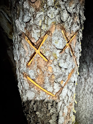
We were up at 3:30 and out the door just befgore 4:30. Apparently there used to be a sign at the trailhead but it's gone, having said that the start of the trail is pretty obvious as long as you don't take the double track straight up from the camp. 5 minutes in we went straight across a creek and I wished I had brought a pole (later Pete was kind enough to lend me his second pole, which I thoroughly abused). Along the way there was plenty of evidence of much appreciated chainsaw work, some rumours circulating that Foresty Forest had recently been in the area.
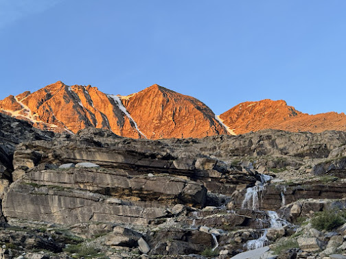
At a couple of points in the dark we had to backtrack to catch the proper trail and in pretty quick order popped out of the bush and made it to the waterfall biv site in an hour and a half with not a lot of elevation gain. Once we cleared the forest we were treated to a glorious sunrise.
Up beside the waterfall the views opened up with the SW Face route straight ahead and the Couloir obvious above to the left. Both routes are pretty obvious from here and shortly they diverge as we climbed up towards the couloir.
It took us roughly another hour and a half to go from the waterfall to the start of the snow climbing. As we approached the snow Pete led the way up some interesting blocky formations with a lot of water flowing. I missed the opportunity to refill water bottles and really hydrate as there wasn't a lot of water from this point until late in the descent.
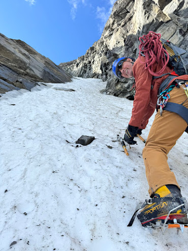
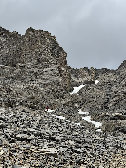
At 8 am we started up the couloir itself and went from a tool and a pole to two tools. The snow was initially good but a touch soft, however as soon as we gained a bit of elevation and got out of the sun it firmed up nicely and made for great step kicking up the neve. We gained elevation pretty quickly and enjoyed the movement. The couloir zigged and zagged a bit with a couple of narrower parts and in spite of the rocks on the snow we didn't get much in the way of rockfall.
2/3 of way up we found a bit of a moat under the rocks to the right we could get into for a full pack off rest and snack, a real luxury!
Further up the angle finally kicked back a bit and we eventually got to the ice patch we had seen from below and thought we could get circumvent easily, which proved to be incorrect. During the ascent I managed to wet 2 pairs of gloves right through and thought of my japanese fishing gloves which work great for wet ice climbing, sitting in a drawer at home.
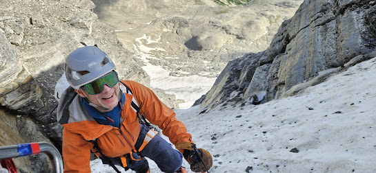
Pete kicked himself a platform below the prominent rock feature in the gully and I went out to test whether we'd be good soloing. Just as I was out 8 metres and realized that it was thin wet snow on ice the sun hit the top of the couloir and a bit of a sluff hit me head on. Not really a threat to knock me off however it did keep it real. I built a screw/ice tool anchor and threw a rope down to Pete, he then passed me for another 8 to 10 metres and put in his screw and belayed me up. We did this 2 more times playing leapfrog before returning to good snow and I built the final anchor in the ice on the right next to rock. After bringing up Pete we then ditched the rope and soloed to the top.
It would have been much more comfortable with a couple more ice screws and my ice climbing crampons, maybe even an abalakov hooker. For not being an ice climber Pete certainly rose to the occasion in somewhat stressful circumstances.
We made the top of the couloir at 12:30 pm and the summit at 1. Great views and a very different perspective of other high peaks in the rockies given our location. It was Pete's 12th summit of the season, nice work for mid July! Simon and party had made it up the SW face and bagged the summit ahead of us and were working their way down while we were on top.
We descended the SW face route however if you managed to get up the couloir without having to pitch it out I'd highly recommend retracing your steps. If it wasn't an 11000er I don't believe the SW face would get climbed much given the rock quality. After making our way along the ridge a sharp left turn took us to the gully of despair. Picture pretty much the worst scree gully you've seen in the rockies and you'll have the pleasure of downclimbing 300 metres of it, although to be fair there was some snow that helped near the bottom.
Once most of the way down a pretty well packed trail lead to the right to enter the first of three bowls that need to be crossed. We pretty much followed somewhat of a trail and good cairns on the entry/exit point to the next bowl.
Along the bowls there were some not badly packed trail in the scree and some not so good where it was washed out. A couple of scrambly bits on loose rock along the way kept things interesting. Big country! Well placed cairns at the entry and exit points of the bowls helped.
We finally broke out on the shoulder of Harrison on the lookers right of the Couloir route near the col and then it became pretty easy sledding back to the end of the road. Do note that Gaia shows the SW face route well however it's track for the north couloir is way off, luckily doesn't really matter as the couloir is pretty obvious.
We traced our steps back to the vehicle at roughly 5 pm for a 12 1/2 hour day. I had a bit of a piano tied to my ass (fortunately not a grand, more a mid sized upright) and Pete would have been a bunch quicker on his own. On the way back we did get a fresh perspective of the north couloir route, a real beaut!
We undid the procupine protection and were quickly on the road. Coming out, it took us 2 1/2 hours driving to the highway. Thanks Pete for a grand adventure!


