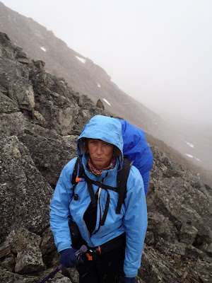
Thursday, 29 November 2012

November Kananaskis Country Ice 2013


November 24-25, Kananaskis

Synopsis: Definitely early season, pretty thin but great just to get back behind the tools!

Geoff, Kim and I headed to Canmore Friday evening.  Meeting friends at the Griz resulted in a few beers, a few games of pool and a late start Saturday morning.

We heard conditions were thin and debated where to try our luck. In the end we settled on the Opal Ridge area in Southern K-Country.  We drove back and forth a couple of times checking the climbs out and the only one we could see definitely in from the road was Solid Cold.  


You can see it high in the gully to Geoff's left, a fair ways in but we needed some exercise.  We left the car about 11:30 without really reading the route description or taking it with us and plunged straight up the gully.  It got pretty entertaining pretty quickly with bush and deep snow with wind slabs.


After a fair bit of thrashing we climbed up to the left to gain the ridge and climbed further on much easier terrain.


We didn't really trust the ridge, or the summer trail, enough to stay on the ridge all the way along so after we came in even with the band of trees on the right we plunged back down.  Ah the joys of climbing and descending frozen scree!


The real heinous part was getting up the last 50 metres to the ice; steep, deep and crusted - a great work out.  Definitely much more like winter mountaineering than ice climbing!  We finally arrived at the ice after 4 hours taken to gain 650 metres.  The ice was great but we had a good laugh at the effort for 20 metres of ice!


It was thin on the bottom and top and pretty funky in between but it felt good to be on the ice.  Once down it was 4:40pm and definitely getting dark, we hammered down in an hour through more fun and games to the best tasting beer I can remember having.

The conditions weren't really the kind to make you consider cutting the night time activities short so we didn't and had an even later start the next day.  We had heard the ice wasn't bad at King Creek further south so headed in.  25 minutes on a packed trail felt pretty luxurious.  It was crowded however we found a nice pitch of soft WI3 to play on.

As I say, great to swing the tools!


Tuesday, 27 November 2012

Early Season Skiing in Rogers Pass 2012


November 10-11, Asulkan Hut

Synopsis: How do you rate early season pow? Good hut, great friends and enough sun to get into the Alpine. It doesn't get much better!

A group of 6 of us met at the Asulkan parking lot Saturday morning at 9.  I don't think I've ever seen such little snow in the parking lot and was wondering about the conditions, especially given the most snow I had seen on the drive was in Edmonton.


Sure enough, we had to boot pack from the parking lot up to the old road however once there put on the skis and started to skin up. Once we started the climb out of the road things got a little bony with rocks and vegetation showing under the larger trees.  The creek was running and there were lots of vegetation sticking out of the snow pack but hey, you can't complain when it's only 5 below.

Due to the conditions, the tracks pretty much followed the summer trail up to the tree triangle.  I don't think I've ever felt so relaxed climbing up through the mousetrap as the slopes above were certainly not loaded.


However, once we were up in the tree triangle things improved immensely.  Obviously a fair amount of snow had blow in and the rain crust that was evident lower down because less obvious as we started to climb.  It did take us a little over 5 hours to climb the 990 metres to the hut.  Partly due to the bony conditions and partly due to my lack of fitness, however there is no better way to work on it!


Once at the hut we claimed a bunk and headed on out at a little after 3 pm.  Viz was good and the snow soft, we had a great run down the tree triangle.  It was a little tracked from the Vancouver group that had been there a day before but we found some untracked on skiers left.  We were down just before 4 pm and it was definitely starting to get dusk, an hour climb to regain the 375 metres and it was miller time!

The next day dawned cool at -15c but not a whole lot of wind. The sky was pretty clear so we left the hut at 9 am and went up high. Spectacular views and boot top powder, much of it wind slabby. But we found a line down the steps to the skiers right of the pterodactyl and it was boot top hero snow.  We stopped short as crevasses were starting to loom and set a track up.


Once up we noticed that others had set a track up the Young's peak headwall and just as we started up it the Vancouver gang started down.  Stability was good and we climbed Young's peak before starting down the headwall.  


Great turns with a little wind slab from time to time to keep you on your toes.  Afterwards another climb and run down the steps, by this time in the day the sun coming and going and we were a few less than the start of the day.  On the last climb the wind picked up, I actually got the first frost nip of the season on the nose and with it getting later in the day we headed in.  It turned out to be a 1400 metre day, not a bad way to start the season!  


The next morning was a little more socked in with some snow overnight and windy.  Fred and Steve headed out as Fred had a flight to catch to Japan.  We headed down to the toilet bowl for the first run of the day at about 9 am with the Vancouver gang.  They soon left us in the dust, however we got in three runs before heading back to the hut for lunch.  After a great lunch and quick clean up headed down the ski out.  It was a lot better than I expected and we were out in 1:45 hrs with a few nicks in the skis but nothing major.


Thanks to Andrew, Brenda, Nick, Steve and Fred for a fantastic weekend!


Tuesday, 2 October 2012

Valley View 2012


Saturday Sept 29, 2012 Valley View 5.9 on Cascade

Synopsis: 4 stars out of 5, a fun 7 pitch sport route with some good climbing and easy access.

Kris and I arrived at the parking lot, just inside the cattle guard on the road to Lake Minnewanka and the light rain just wasn't letting up.  Finally at 10 am it looked to be clearing so we hit the trail.  


The trail is pretty obvious and it is a rare joy to be able to see the entire route from much of the approach.  It is a bit of a grunt and the sun came out in time to ensure some sweat.  We arrived at the wall and scrambled up in our approach shoes just left of a short wall with a bolted anchor.  Kris scrambled up to an old dead tree and spotted bolts just past the gully to the left.  Checked it out on descent and it appears to be the right start.


I lead the first pitch, pretty compact rock.  Kris got the second pitch with one 5.9 move and kept going to link up pitch 2 and 3.  While he was belaying me the wind picked up in earnest and it actually snowed a bit.  I was climbing quickly figuring we would bail but when I got to the belay the sun came back out!  Kind of set the tone for the day.


The next pitch was great prickly limestone and felt about right for the 5.9 grade.  We took a small rack but the only piece we placed was me when I didn't see a bolt close by early on.  Pitches were short, 10 draws more than did it.  Kris put the 5th and 6th pitches together without much rope drag and the climb started to live up to it's name.


The 7th pitch was fun but a lot of scree up near the belay made it hard to keep rocks off the second.  We were at the top 3 hours after starting to climb and scampered up to some ledges for lunch.


With a combination of lowering and rappelling on the bolted anchors we were down in just over an hour and were back at the car around 4:30 for a 6 1/2 hour day.

Recommended for a fairly short fun day out although next time I wouldn't take any gear and we did knock off a couple of rocks so wouldn't be keen to climb under another party.

Friday, 28 September 2012

Mt Woolley & Diadem 2012


Saturday/Sunday/Monday Sept 22-24, 2012 Mt. Woolley 3405m Mt. Diadem 3371m

Synopsis: 3 stars out of 5, two 11,000ers in a beautiful setting with great views of Mt Alberta and the North Twin.

James and Andrew met in Lake Louise and picked me up at Saskatchewan River Crossing at noon on Saturday.  It was a perfectly blue sky on the drive down and between the mountains and the fall colours it was a beautiful drive.  The pull off is just 12 km north of the ice field visitors centre and we left the car just after 1 pm.


Likely the most dangerous part of the trip was crossing highway 93 with an overnight pack on a sunny afternoon, after that the Sunwapta river crossing was nothing.  Being fall it wasn't mid calf, although still a little chilly!


The trail was a pretty good trail up the gorge and once up a bit the spectacular peaks of the MacArthur group come into view.  In the photo below both are over 10,500' and look like interesting objectives in their own right.


About then we came to a bouldery section and took a trail a bit higher than Woolley creek.  On the way down we saw the error of our ways, the good trail is right next to the creek.  3:45 hrs and 675 meters of elevation gain put us at the biv site, there was a few to choose from.  We did have neighbours, a team of three from the UK.


We spent most of the very short evening reading over the three different route descriptions we had attempting to plan the next morning.  Our plan was to attempt the regular route which we thought would go up the rock between the two snow gullies in the photo above.  The SE face route, the right hand snow gully, looked interesting however we were a bit concerned about snow quality.

Sunday morning, up at 4:30 am and we were walking at 5:30 anticipating sunlight at 6:30.  In spite of a chilly evening it was a balmy 7 above when the alarms went.  We skirted the lake and followed scree on glacier as much as possible.  After roping up for a short section with some significant crevasses, we caught up to the other team at the nose of the rock, between the two snow gullies, at 7 am after a gain of roughly 350 m and with not a hint of sunlight.

All 6 of us worked left and right on the choss pile that made up the toe of rock attempting to find a route through.  After an hour of futility, Andrew finally put his hands on his hips and uttered "I'm sooo done with this" (likely caused by sleeping on a female specific thermarest).


We immediately escaped climbers right and jumped on the SE face route.  Needless to say it was a pleasure to be on snow.  Funny enough once we climbed up to the large snow patch on the rock to our left, Andrew and James saw a significant cairn on the other side.  We skirted around the bottom of the snow patch and climbed a short chimney feature to the cairn.

 
This was the passage through to the left hand snow gully.  There was a bit of a trail rising diagonally through the loose rock.  It made sense as our goal was to gain the left hand snow filled gully above the area threatened by serac fall.  Not great rock but pretty easy travel none the less.


We then jumped in the snow gully for a short steep (40 degree) section before breaking climbers left through a gap in the rock.  We had a second tool and ice screws just in case, but they weren't close to being necessary.  The sun was starting to make itself felt however there was some significant smoke in the air.  Not good for the views but likely saved the snow very getting too sloppy on the descent.


I expected to go around the corner and be on the Woolley/Diadem col however it was a fair way back.  We arrived at the col at 10 am at roughly 3100 m.  We chose to climb Woolley first as it looked more inviting, a long ridge with an interesting bit mid way.


On top of Woolley at 11:15 am, as mentioned it was a little smokey but we still had great views of Mt Alberta with some of the biggest hanging glaciers I've ever seen in the foreground.


There was a bit of wind but it was still pretty mild, especially given it was the end of September.  Nice view back to the campsite down by the lake!


It was a pretty simple exercise to retrace our steps to the col, near the col there are a few crevasses however we felt comfortable without the rope.  Back at the col shortly after 12:00 pm, we started the rocky scramble up to Diadem.


On the way up Diadem, we met the other team coming down as they stuck to the SE face.  They were going out that night so were descending and skipped Woolley.

The top of Diadem is a straight forward snow slope after you scramble up the scree, we didn't even put our crampons back on.  Having said that once on top we saw the small rock outcrop further on that just might be higher...


It turned out not to be (just) but it is a fun scramble with a bit of exposure to liven things up.


On top of the rock pinnacle at 1:15 pm, we retraced our steps back to the col and then back to camp.  Pretty straight forward, we were in camp at 4:30 pm with a grin on our faces.  After 11 hours and 1400 metres of elevation gain there was a short discussion about packing up and heading out but we opted for the nice meal, scotch, sunset and bug out in the morning.


Wouldn't you know it, the next day dawned clear as a whistle.  We waiting for the sun to warm things up before getting too carried away.  Broke camp and left at 9:30 am and were back at the car in two and a half hours.


We did discover that a climb isn't complete without a theme song, one that Andrew started singing after I called him a negative nelly:


http://youtu.be/9m7tPikH0UA

Thanks to Andrew and James for a great weekend!


Friday, 7 September 2012

Willingdon Attempt 2012


Sept 1-3, 2012

It was set to be Ross and Deanna's excellent adventure.  You know the story; big plans, long weekend and great weather forecast.  We knew it wasn't going to be text book when we arrived at Mosquito Creek parking lot Saturday morning shortly before 9 am to torrential rain and wet snow.  Hmmm!  We sat it out in the car for an hour and sure enough, a sucker hole of blue sky spurred us into action.


Off we went at 10, basically following the trail to Mosquito Creek campground for an hour until a bit of a trail to the left just before the 3rd bridge.  We followed this trail which follows the left hand side of the creek for another hour and a quarter.  A little tougher going and we managed to get soaking wet from the branches grabbing at us.


We then headed up through sparse bush as per Bill Corbett's directions and made our way up to a bit of alpine meadow.  The weather was coming and going with a bit of snow and grapple but not enough so send us home.  Our goal was to pass through Quartzite Col which is just to the right of my head below.


We managed to make the col in 5 hours from the car, not bad for a guy recovering from a broken ankle and a girl that doesn't climb (apparently Cotopaxi doesn't count!).  We traversed into the col from high and spent more time in awkward blocky terrain, could have saved time and energy by entering the amphiteatre lower and heading straight up to the col.  We managed to make the col in the middle of a particularly energetic storm cell, I was happy not to hear any thunder.


Deanna may have mentioned once or twice that she wasn't happy with the weather but we elected to carry on.  Fortunately, just after we did the cloud lifted and we could at least see our way down to the Siffleur valley.  Descending the other side of the col is pretty steep, we found some passable terrain well to the climbers right of the col, an alternative would have been to descend a steep snow slope right under the col.

Once down onto the Siffleur the terrain was stunning, not much of a view of the mountains but interesting terrain and soft under foot.


A bit undulating and a few creek crossings later we picked up the horse trail coming in from Pipestone valley and made our way up to Clearwater Pass.  Unfortunately, shortly about then it started to snow in earnest.  At about 6 pm we were getting a little weary and hid under some trees, ate something and agreed to carry on for 1/2 an hour and if we didn't find Devon Lakes we would just camp wherever.


Funny enough, as soon as we got back on the trail the snow eased enough for us to realize we were 40 metres from the lake and right beside the creek we were looking for!  We quickly set up camp as it continued to snow and found a clump of trees to cook under.  After a 9 hour day with a little over 1,000 metres of elevation gain in a raging blizzard it was good to be in the tent.


The snow and wind continued through most of the night and it was pretty obvious we weren't going to get up any mountains however it cleared enough in the morning to allow for a great view of the start of the route on Willingdon to the right of the nipple on the ridge below.


We had a bit of a relaxing start to the day and elected to take the long way back and spend another night out.  We packed up and headed towards Pipestone Pass at 11 am.  It stayed cold and windy but the cloud cover came and went enough to get some great views.


Two and a half hours got us to Pipestone Col which was pretty spectacular albiet chilly.  A little scotch out of the wind helped us to forget about the cold.


Carrying on down the Pipestone valley was spectacular.  We carried on for a little over an hour and just before Moose Lake headed up and over to shortcut back to Mosquito Creek. 


The route up and over takes a line of least resistance just before the large face of snow on the right above a green bench.  Given all of the obvious bear territory and no other people around I was surprised not to see any wildlife.  The climb up to the unnamed col was pretty straight forward as you can see below however we found more hoof than boot prints.


On the other side was a descent of about 200 metres to a little lake that we elected to set up camp beside.  It was still cold and windy so we spent the evening wearing every bit of clothing we brought.  In fact we had to heat up the box of wine to get it up to room temperatures!


In all it took us 7 hours to get here from Devon Lakes at a pretty pedestrian pace and there was 700 metres of elevation gain.


The next morning we tore down camp with threatening skies but managed to get out without getting wet.  It was beautiful terrain on the way down to Mosquito Creek.  At one point we were following bear tracks through a meadow with lots of signs of digging however the lack of steaming scat kept the heart rate down.


We left at 9 am, joined the trail after an hour and a half and made it back to the car in three and a half hours including a few rest stops.


Probably the most fun I've had without climbing a mountain.

Tuesday, 29 May 2012

Climbing in Ecuador 2011

Climbing in Ecuador

June, 2011 Synopsis: 4 1/2 out of 5 stars, like the guidebook says - "Ecuador is a wonderful destination for intermediate mountaineers looking to get some experience at elevation" what they don't say is the locals are friendly and things are pretty cheap.

We arrived in Quito on the 30th of May and checked into a hotel in old town which did the trick perfectly.

Wednesday June 1/11  Pasachoa - attempt

We got up, had breakfast in the hotel and made our way to the bus stop, it was a bit full on and I attempted to stomp through like Forest Gump however MENSA chick made me stop and ask directions.  9:00 am got on a bus for Amaguana, with lot’s of stops it took roughly an hour - cost $0.85 for both of us.  The bus conductor was good enough to help get us a camionette at the stop however it turned out to be a small car and cost less than the rate mentioned in the guide book so we were in good hands.  The driver was a young lady whose name was Linda and she spoke just a bit of English.  The ride up to the start of the climb took roughly ½ hour on a very rough road of 7 km’s and cost $7.  Ended at a refugio at the Buogue Forest.  


This was a different spot than I was aiming for however would do just fine and we got a great hike through the rain forest.  There was a park entrance and a little man took $2 for us to enter and gave us a map.  We started hiking at 10:40 am at roughly 2700 metres.  Good trails for the first part however very wet.  The sky was threatening however didn’t really rain hard on us, just sprinkled.  The ground was quite slick in places and there was a lot of bird song.  We were in thick forest until noon at which time we gained a ridge, still in forest and quite cloudy so not a lot to see.  The map showed the end of the trail being Ruma Lumo and we reached there just after 1:00 pm at 3090m.  Just before then emerged from the forest and made our way up damp long grass, tricky footing.  Ruma Lumo was a saddle, unfortunately not much for views due to the clouds.  We stopped for lunch and then took a little bit of back and forth to determine the correct way.  We then made our way around the ridge line through very interesting terrain on the back side of the volcano.  It became apparent that we weren’t going to summit and get back to meet Linda for 5 pm so we turned around at 3600m at 2:30 pm, note the styling rain pants!  


Raced back to Ruma Lumo and made it just after 4:00 pm.  Slid our way down the trail and just 5 minutes from the parking lot heard Linda honk her horn, our spanish worked and she had come back to get us!  6:30 hour day and 900 metres but we were wet and tired.  Linda took us to where the bus could meet us and the bus happened by as we were getting out of the car!  We ran for it and it turned out to be the same bus we took there.  The conductor greeted us like old friends and we settled in to a more crowded bus for the hour ride back to Quito.  Walking out of the bus terminal at “rush hour” was unforgettable, an absolute zoo!  

Thursday June 2nd Rucu Pinchincha - 4696m

We took a $3 taxi ride from the hotel to the teleferico, a very slow Gondola that took an hour but gained 1,000m of elevation and dropped us off just after 10:00 am at 4100m.  There was a little coffee shop (Nescafe) at the top and we shared the teleferico with a french couple who were climbers and a Bolivian in Quito for work.  After using the washrooms left at 10:30 am, not much to see at outset with low clouds however it improved.  


There was a very good trail to start, quite gentle as it followed a ridge.  After Pasachoa it was good to be above tree line.  Quite industrial early on as powerlines passed close by however the terrain was gently undulating and a great view of Quito appeared as the clouds burned off.  Got to the end of the well defined path and the start of the real climbing at 12:30 pm at roughly 4500m.  The lungs were definitely feeling it but low and slow was our mantra.


We stopped and had some lunch in the lee of the ridge.  The trail then skirted the ridge to climbers right, some interesting features and a real muddy section before some sand and finally some great blocky climbing on excellent rock.  Some exposure and cairns marked the route.  We made the summit at 1:30 pm and were surprised by a large sign and quite a bit of graffiti with a few cigarette butts thrown in. Clouds came in about then so no great views however we made it through the day without getting wet.  While on the summit an Italian in shorts and running shoes lept up with his mother yelling something about Luigi in the background.  When we finally left the summit met a guy from Boston not doing well with the altitude.  A quick descent put us back at the start of the trail at 2:40 pm and back at the teleferique at 3:40 pm for a 5:10 hr 750m day.  Great fun!  Waited a bit for a taxi and got one for $5 back to the hotel.  We were both a little spent from the excercise and elevation, went easy on the booze (like none) and drank lots of water.


Saturday June 4th El Corazon - attempt

We spent the day before moving to Machachi, roughly an hour south of Quito.  The day started with a rooster waking us up at 3 am and both of us having a good bout of travellers tummy.  We planned to get out the door at 7 am however that time saw a low cloud cover and both of us sitting on the bed wondering if we could go the entire cammionette ride without having to run to the loo.  We finally sucked it up and left at 7:40 am for the 5 minute walk to the cammionette’s, found a very nice driver who gave us a ride to the gate for $4.00.  Funny scene as many locals were getting rides in pickup trucks (we counted 17 in the back of one) to work in the fields and going through at the same time.  We had to sign in with a couple of security guards however I never really understood what was going on (not highly unusual).


We started hiking at 8:00 am at 3300m and basically climbed the first hour up a stone, then gravel road the trucks used.  Finally stopped for a second breakfast at three pines as we were cutting through an uncultivated field.  It was roughly 9:30 and at 3800m, beautiful views and starting to feel a little better.  Cotopaxi started to come into view.  We walked up a trail further and realized that we took a short cut and got back on the road that took the long way around.  The next several hundred metres were above the fields however we were following a road that switched back and forth and gained the hump we could see from the road.  It then meandered to climbers left and went a fair ways back before getting close to the peak proper.  Finally at 1:00 pm and 4390m we came to the end of the road with a bit of flagging and found a path through the long grasses towards the saddle.  It became apparent that it was a longer day than we calculated and we would have to turnaround at some point to get down before dark.  Once near the col we started scrambling on rock with a few cairns and some flagging from time to time.  Fairly straight forward however the day was taking it’s toll, we still weren’t feeling well and were moving fairly slowly.  Turned around at 2 pm at 4629m, took a couple of photo’s and started down. Why do I look like I'm going to hurl and MENSA chick looks like she's on a picnic?


With the good footing once we hit the road and good paths down it went quickly and we were back at the three pines at 4 pm.  A few poo stops on the way down to clean the system out.  Got back to sign out at 5 pm and walked down and around to the train station.  We asked a couple of locals about a taxi and they motioned us to the Hacienda close by.  Very nice people showed us the wonderful digs (especially compared to the relatively dumpy place we were in) and let us sit down while they called us a cab.  9 hour day, 6 hours up and 3 down and 1320m gained it felt like a lot of work as we were not feeling 100% but we could also feel that we were acclimatizing. Later on we found that the place we were staying also used the main hall for funerals, things that make you go hhmmm!

Monday June 6th Illiniza Norte  5126m

We moved to the small town of El Chaupi and stayed at Hostel Llovizno, much nicer.  Vladimir was the owner and spoke pretty good English.  We were up at 5:15 am and had the included breakfast of jugo, huevos, cafe and great jam.  Left at 6 am with Vladimir who gave us a ride to Le Virgin (a small statue) and we had to pay $2 each to enter the park on the way.  The day started off sunny with great views of Cotopaxi.  We started walking just after 6:30 am at 3900 m and just after got started a well behaved dog joined us and followed all the way to the summit ridge.   


We had to make some route finding decisions following rough vehicle trails through the trees, went left and doubted but it turned out to be the best approach.  As we got higher the views of the valley got better along with Pasachoa, Corazon, Cayambe and Antisana.   Pretty easy trekking until we got to the Refugio, which some stay the night.  On the way up passed a couple of french climbers descending along with guide and cook.  The cook told us the dog came from the village however was a mountain dog and had been to the top of most of the peaks in the area.  We arrived at the refugio at 9:30 am at 4607m, definitely feeling short of breath but pretty good otherwise.  It was a very clean and well kept refugio, we used the washrooms and left payment for it to keep the mountain gods on our side.  Nice trail from there to the Norte/Sur saddle then got scrambly with primarily good rock.  


We passed a spanish couple, the gal looked completely spent and the dog must have sensed something because it followed them down.  It slowly got steeper with some sandy areas however I followed some great directisimo bits up good blocky rock that looked like granite.  Finally passed around in front of the summit, some exposure but had trouble figuring out where the “passo de la muerte” was.  Then a bit of a steep bit on sand and loose rock to the summit ridge and onto the summit which you didn’t realize until were on it.   Summited at noon, with a large metal cross on the rock.  We stopped and enjoyed some lunch and the view as clouds came and went.  Very happy to be there and definitely sucking air!  I enjoyed this climb every bit as much as Cotopaxi.


We took an alternative way down which was more of a scree and sand descent. Came off the summit and down climbed some rocky bits, then across ridge with snow just above us and basically followed the track.  Very easy going and lost elevation quickly.  As we got closer we called for a ride on the radio Vladimir gave us however no one answered the calls.  Tried for the last hour down to Le Virgin however no response.  We met a young German and French couple who were climbing up as the weather was starting to turn.  Found out later they took the wrong turn and climbed nearly to the summit on the downtrack and eventually gave up and walked all the way back to the hostel arriving at about 9 pm!  Back at Le Virgin at 2:45 pm for an 8:10 hour (5 hours up and 2 ½ down with ½ an hour on summit) and 1250m day.  Met up with the spanish couple who had called a cammionette and we got a ride in the back, later Vladimir tried to say his wife called that cammionette for us but doubted it - ah life in Ecuador, it always works out but you don’t always understand how!


Wednesday June 8th Cotopaxi  5897m

We agreed after breakfast with Vladimir to go for it and organize a guide for the two of us on Cotopaxi, then we both feel pretty sick for a bit.  The guide, Marco showed up at the Hostel shortly thereafter and we all had lunch together at 1:00 pm. H spoke English although not terribly comfortable with it, obviously an experienced guide. Marco also had interesting skull and cross bones tattoos on back of each hand, more things that make you go hhmmm!  The four of us drove to Machachi and we hit the instant teller and forked over $200 each, then Vladimir departed on foot and Marco drove us to Chilcabamba to drop our packs off to stay on way back (one of the advantages of traveling with a girl, it was a higher end fantastic place to catch up on sleep after the climb).  We drove through the park which is pretty desolate near Cotopaxi and up switchbacks to the parking lot.  We left the parking lot at 3:30 pm and arrived at the refugio at 4:30 pm, 4800 metres.  


It was a fairly large refugio, max 75 people, however fortunately not nearly full. We took a couple of bunks and stored our stuff in one of the large lockers supplied using our padlock.  Met some others climbing and some who just came out to stay, many were sick and hadn't acclimatized much.  Marco made us chicken with mushrooms on spaghetti for supper and it was awesome.  We went to bed at 7:30 pm however lied awake for some time, I got up to take a leak and there was a clear sky and awesome stars, however gasped for air in the sleeping bag.  12:10 am woke up having slept through the alarms.  I took another 250 mg of Diamox after taking the same the previous noon, supper and just before bed.

We left the hut at 1:15 am, scrambled climbers right of refugio for 30 minutes until we hit the snow and put on crampons.  We then scrambled up perfect cramponing snow, mostly clear however quite windy with the occasional gust containing grappel.    One woman and guide passed quickly, a large group was just behind however we put distance on them fairly rapidly.  I was having trouble with my headlamp as it was old and (like me at times) not very bright.  We stopped at 2:45 to rope up at 5175m, up until then pretty consistant 30 degree snow slopes.  We were using the one mountaineering axe and one ski pole technique and Deanna was tied in just behind guide and I was 4 metres behind.  Marcos was good with MENSA chick, giving her instruction along the way as it was the first time she had used crampons.  From here up I didn’t see much except what was directly in front of me. We worked our way up to around the right hand side of a large rock face.  4 pitches of steeper snow about then however didn’t belay anything.  It actually got quite cold on the hands and we used handwarmers, it was coldest between 3 and 5 am and I would estimate 5 below celcius.  I found the pace pushing it and spent most of the way up huffing, MENSA chick seemed to be doing better.  We stopped 3 times in all for food and drink and to catch our breath, the last time at the top of the rock step at 5600m.  Some interesting crevasses and features going around the rock face, definitely large terrain.  We met the fast gal coming down with her guide about then.  On the way up, Marco had to stop a few times to check the way otherwise we were just following crampon tracks.  I had tingly fingers from the Diamox early on however once around rock face started to get clouded vision in my right eye and as the day wore on in both.  It was quite slow from 5600m to the summit and just before summit the sun started to come out and we turned the headlights off.  We summited at 6:15am, 5 hours up which felt pretty quick.  It is a broad summit looking into old valcano crater, great views of surrounding peaks including all of the high ones.  


Unfortunately, my vision was still clouded - felt like cataracts and stung just a bit.  I thought it might be the blast of grappel every now and then as climbed (should have had goggles) however after some research believe it was because I took too much Diamox.  It was definitely a lot of work, however have hurt worse.  Spent 30 minutes walking around in a daze on the summit and eating some great tasting food (including a twinkie like roll).  


Two female English teachers arrived on the summit just before us and we had a great chat.  Descended quite quickly - 2:15 hours.  Snow good all the way down, didn’t soften up as some cloud came in.  My vision got a bit worse and couldn’t take photos.  Neat to climb down in the daylight and see what climbed up.  


We basically went straight down the lower part to the rocks.  I had one loose boot and didn’t bother tightening it up.  Should have as my big toe swole up and got red and sore for a couple of days, eventually lost the toenail.  We got down to the rocks and took off our crampons and harness, rested for a bit then headed back to hut.  Arrived back at 9 am, 5 hours up, ½ hour on summit and 2:15 down.  Rested, organized and rehydrated until 10:30 am then Marcos gave ride to Chilcabamba.  
Deanna tipped him $30 which he didn’t seem to expect and Chilcabamba was a treat - perfect way to recover and my sight came back in time for supper (after much sleep).  Great adventure, got up early the next morning to watch people climbing Cotopaxi through the scope at the hotel.