Hungabee, August 18th/19th, 2024 - 3491 metres
Synopsis: Hungabee is a tough one to give a star rating. The rock isn't always as bad as the reputation, in fact the scrambling up the "indistinct rib" after the traverse was a lot of fun and the airy ridge up high was a highlight. Not sure I'm in a hurry to go back but happy to have climbed it. As often the case the bivy site was fantastic!
Paul organized the biv permits and bus pretty easily, $44 each and a seat on the 3:30 pm bus into Lake O'Hara on Sunday. There had been some snow up high on Friday night however everything up high looked dry driving in and the parks people backed that up so game on!
With overnight packs loaded, we made our way around Lake O'Hara and up East Opabin Trail which joined part of Yukness Mountain Route before breaking off towards Opabin Pass after passing the gorgeous Hungabee and Opabin Lakes.
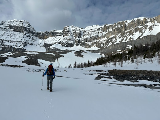
We stopped to fill up with water at Opabin Lake and pulled out the filter just in case. On the way up to Opabin Pass there is a small glacier to cross and some soft snow beyond, crampons helped and it was easy to dodge and weave around the obvious crevasses higher up.
It's another 200 metre elevation gain to Little Opabin and down 30 metres on the otherside to a great biv site at roughly 2750 metres with plenty of snow handy. In all it's a 760 metre elevation gain to the biv site and it took us 4 hours at a pretty leisurely pace.
The biv site was a very cool place with a full view of the route, Wenkchemna pass to the south along with Neptuak and Deltaform poking out behind. We were treated to a spectacular full moon and clear skies overnight, the wind even died down.
We carried on working our way just to the left side of the rib, do note that the lower part of the rib made up the largest chunk of the vertical elevation gain of the day. Obviously if and where you put on the rope varies wildly however when we got to where we roped up we could see down and to climbers right to the cairns and where the original West Ridge route goes. Looking down on it you could see why Larry's variation is the standard route now.
Right about then we could see two climbers catching up, it ended up being Haldon and Darren who were doing an impressive job soloing what we just climbed. They caught us up at the summit.
Just past the alcove there was a slung rock set up for a rap anchor and I used that and Paul lead up the top of the yellow band and through the black band near the climbers left. The yellow ground went easily but there were a couple of moves mid fifth grade with good gear in the black band. That left us on the upper ridge just short of the step across. Having climbed Front of the Pinnacle at Bon Echo a long time ago and having the benefit of wingspan it's actually a bucket of fun, having said that I would have had a pants full without the benefit of a rope. Just past the step across was a solid rap anchor which I used to belay Paul across, we then left the rope and scrambled to the summit.
After half an hour of snacking and enjoying the view, we headed down. My plan was to use the rap anchor just before the step across which I though would take us close to the block 3/4's of the way up the yellow band that I had used as a belay station and then rap down to the beaten in trail that bypassed the sharp ridge back to where we attained the ridge itself. It largely worked although with a 60 metre rope we can some down climbing that I would describe as loose and unpleasant on the yellow band.
In the photo above you can see Paul partway along this pathway, along with Haldan and Darren on the summit ridge. Having descended that way I was glad we didn't choose to go up it. Pretty scrappy.
After 5 raps down the ridge we ended up on some chossy ground with two single piece, older rap anchors. We backed one up and rappeled over a short grey band which I realized later was part of the old west ridge route. We were still above 3200 metres so too high for the traverse back to the original ridge on the black band but we traversed to the south first, realized what was going on and traversed to the north (climbers left) across a couple of gullys to terrain we recognized and started to down climb. Once we were on the "indistinct rib" and recognized the terrain it was a matter of down climbing on somewhat solid rock to the traverse. It was further down than expected, but we kept an eye on the altimeter and finally found that cairns and packed trail that lead back at close to 3000 metres elevation.
After that it was pretty straightforward descending. Once at the lower ridge we tended to stay slightly climbers left of our route up on looser but more moderate ground. We did run into a number of dodgy rap stations but ignored them and carried on. There's a large rock blob on the ridge itself that is a great landmark.


.jpg)


