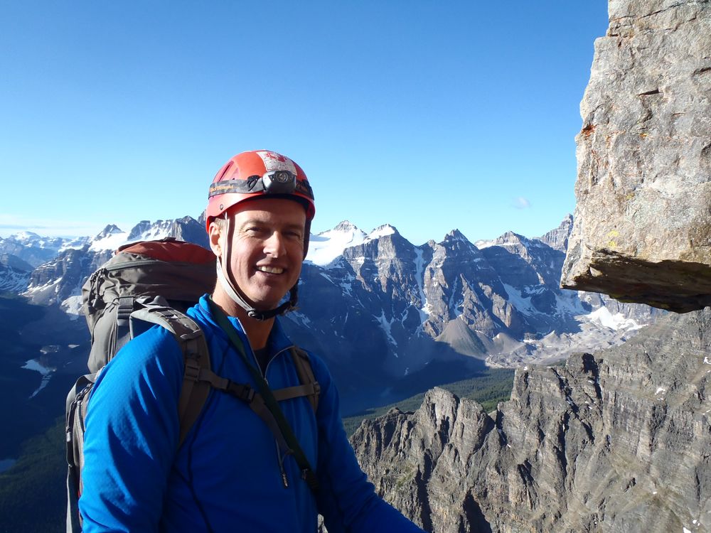
Sat/Sun/Mon Aug 3rd/4th/5th - Lunette Peak 3400m
Synopsis: 2 1/2 out of 5 stars. This is an amalgamation, one of our party rated it 3, one 2 and one AL (avec larmes). Expect a beautiful biv site, lots of scree, challenging route finding, rockfall and solitude.
Armed with Bill Corbett's description, we met at 9 am at the Settler's road turnoff just of highway 93. After dropping a car off just past the bridge at the 14km mark, we carried on. The road to the Baymag plant is in excellent shape, the spur at the end less so but still fairly easy travel.

Andrew, Brenda and I parked the trusty CRV at the bottom of the hill to the first bridge given the rough road and dodgy bridge. After wrapping the vehicle in chicken wire we carried on up the road at roughly 11 am. We crossed a second bridge and 1/2 an hour into it reached the path into the cut block. There was a pick up truck parked right at the cut block and spare chicken wire around so you can save some walking with a high clearance vehicle.

Just up the obvious path, we were surprised by a parks registration book. This path obviously gets a fair amount of use going into the Hind Hut to climb Assiniboine. Given the flooding earlier, the trail was in great shape and we made pretty good time, climbing steadily.

An initial water crossing was pretty easy and at the second we found the log and cable 25m upstream. It added a bit of spice but nothing too dramatic.

After that we followed the shore of Assiniboine Creek, a beautiful setting. At one point we scared a couple of white tail deer, and I just about stepped on a mother grouse attempting to scare us off. There was some bear scat on the trail but we didn't see any other signs.

The description calls for a faint trail turning off from the main Hind Hut trail to head towards Lunette and we started looking pretty early. In the end it is a beaten path and well marked with a cairn. By the time we reached it we were 3 hours in, including a healthy lunch break, and 460 metres up.

Not far ahead was Lunette lake, a beautiful spot with a good view of the biv site above, along with Lunette and Assiniboine right above.

Now the real work started, after crossing the outflow the trail follows the shore for a short stint and then turns 90 degrees and climbs steadily before heading towards Mt Sturdy. From here the three of us climbed steadily through the forest, fortunately marked with surveyors tape along the way.

At about the 2100 metre mark, we went straight across the first two scree slopes and climbed the third. The biv site was one scree slope directly above a small waterfall which we reached in 6 hours, it was an 1100 metre day.

The biv site was spectacular, nice soft vegetation for sleeping on and complete with a small stream for water. We enjoyed the evening and the sky even cleared up.

Next day, given the not terribly positive weather forecast and perhaps the chance to climb Assiniboine as well, we were up at 5 and out at 6. In spite of a cafe mocha, I was a little sluggish starting out however the start of the climb is through pretty lush surroundings, followed by the inevitable scree slog.

The coilour mentioned in the directions is the pretty obvious one in the middle and is likely the longest snow coilour I've climbed. We arrived at the bottom in an hour and it was great snow for cramponing and fairly steep in places.

There was a modestly tricky rock step to pass before more snow and we gained elevation quickly.

The day started with the peak a little clagged in and it came and went through the early going though never really added to the route finding challenges.

Once out of the coilour, we went hard right and climbed a ridge of fairly interesting blocky terrain (mixed with a healthy dose of scree).

Along this area the surveyors tape reappeared and in places was a bit over the top. We passed search and rescue tape at a clearing near the road in the day before and we wondered if it was related. Interestingly enough, within a couple of the taped cairns were gloves and in several of them tent pegs were inserted. Definitely a bit of a mystery.

I believe the clockwise that Corbett mentions is right and we made our way up loose scree and some snow angling up and then went hard left before cliffs. The terrain in this area is pretty scrappy however we started to aim for a snow slope that goes up to the Assiniboine/Lunette col.

We choose the right most snow slope that ended in a small col and took it right to the top. Mid way there was a 4 metre ice section and right about then the weather closed in. We had some wind and a fair amount of grapple. Things did start to feel a little more serious.

At this juncture we were 5 1/2 hours into it and had gained the majority of the elevation of the day. The summit block was quite a route finding challenge, compounded by the lack of visibility and the snow that started to fall.

We attempted to go to the far end however other than a fantastic view down the north side of Lunette there wasn't a real reason to be there. What we found is that the true summit is first major block as you traverse in. The best route we could find was just past it and then up and traversed back left crossing the typical down sloping scree ledges.

We then made our way to climbers left of the true summit and climbed easy, airy ground around the backside and up.

At one point, I was traversing on a ledge and knocked a 1/2 a microwave sized block out with my belly (time for a diet maybe?) that was enough to knock me over. Fortunately it was in an area of little consequence however managing rockfall in this area was a priority.

We hit the summit at just after 12:30 pm, 6 1/2 hours and a 1,000 metres up. Given we were in a lull in the weather and it was looking like it would get worse we spent all of 10 minutes on the summit.

I spotted a good rap station just below the summit and we made use of it. Having only a 30 metre rope wasn't an issue as it put us on a ledge past the worst of it and we scrambled down from there. On the way down we found a better line, as is often the case.

We took a different line down the side of the final snow slope to avoid the ice and it went pretty well. There was a brief discussion about attempting Assiniboine while we were up high however the final word was from the blushing bride, suggesting a rating change to AA (avec avocat).

The way down was slow, given a complete lack of visibility in places and our general sense of confusion. Funny, I nearly kissed the surveyors tape that I had derided only hours before.

After getting back to the ridge the skies opened up and it did start to rain in earnest. Fortunately, it wasn't cold and it beat snow. We were also entertained by some of the most deafening thunder I had heard in a long time, fortunately when we were in a sheltered spot. Luckily, it didn't develop into much.

After down climbing the endless coilour, we made our way down the scree. Coming over a mossy hump we could see the camp and two marmots sensed us watching and ran off.

In the end, they hadn't been able to get into the rock encased food cache but had spread out the pots we left out under a rock and hauled Andrew's large pack out from under the tent and had a good chew. Fortunately, the pack was wearable but it did add a little excitement to the end of the day.

A 12 hour day in the end, fortunately the rain eased to showers and we quickly had the silt tarp erected and enjoyed some supper.

The night was a little odd weather wise, at one point the sky cleared and then at 5:30 am hard rain hit. I would have liked to see film footage of my inch worming my biv sac under the tarp without having to get out.

We had a leisurely breakfast and pack up and were out at 10. 4 1/2 hours down included a couple of lunch stops, the last one by Assiniboine Creek in the sun.

In lucky fashion we hit the car just as the sky's opened up again and we escorted from the area to claps of thunder.
Not sure whether I am in a hurry to do it again but happy for the experience!
Armed with Bill Corbett's description, we met at 9 am at the Settler's road turnoff just of highway 93. After dropping a car off just past the bridge at the 14km mark, we carried on. The road to the Baymag plant is in excellent shape, the spur at the end less so but still fairly easy travel.
Andrew, Brenda and I parked the trusty CRV at the bottom of the hill to the first bridge given the rough road and dodgy bridge. After wrapping the vehicle in chicken wire we carried on up the road at roughly 11 am. We crossed a second bridge and 1/2 an hour into it reached the path into the cut block. There was a pick up truck parked right at the cut block and spare chicken wire around so you can save some walking with a high clearance vehicle.
Just up the obvious path, we were surprised by a parks registration book. This path obviously gets a fair amount of use going into the Hind Hut to climb Assiniboine. Given the flooding earlier, the trail was in great shape and we made pretty good time, climbing steadily.
An initial water crossing was pretty easy and at the second we found the log and cable 25m upstream. It added a bit of spice but nothing too dramatic.
After that we followed the shore of Assiniboine Creek, a beautiful setting. At one point we scared a couple of white tail deer, and I just about stepped on a mother grouse attempting to scare us off. There was some bear scat on the trail but we didn't see any other signs.
The description calls for a faint trail turning off from the main Hind Hut trail to head towards Lunette and we started looking pretty early. In the end it is a beaten path and well marked with a cairn. By the time we reached it we were 3 hours in, including a healthy lunch break, and 460 metres up.
Not far ahead was Lunette lake, a beautiful spot with a good view of the biv site above, along with Lunette and Assiniboine right above.
Now the real work started, after crossing the outflow the trail follows the shore for a short stint and then turns 90 degrees and climbs steadily before heading towards Mt Sturdy. From here the three of us climbed steadily through the forest, fortunately marked with surveyors tape along the way.
At about the 2100 metre mark, we went straight across the first two scree slopes and climbed the third. The biv site was one scree slope directly above a small waterfall which we reached in 6 hours, it was an 1100 metre day.
The biv site was spectacular, nice soft vegetation for sleeping on and complete with a small stream for water. We enjoyed the evening and the sky even cleared up.
Next day, given the not terribly positive weather forecast and perhaps the chance to climb Assiniboine as well, we were up at 5 and out at 6. In spite of a cafe mocha, I was a little sluggish starting out however the start of the climb is through pretty lush surroundings, followed by the inevitable scree slog.
The coilour mentioned in the directions is the pretty obvious one in the middle and is likely the longest snow coilour I've climbed. We arrived at the bottom in an hour and it was great snow for cramponing and fairly steep in places.
There was a modestly tricky rock step to pass before more snow and we gained elevation quickly.
The day started with the peak a little clagged in and it came and went through the early going though never really added to the route finding challenges.
Once out of the coilour, we went hard right and climbed a ridge of fairly interesting blocky terrain (mixed with a healthy dose of scree).
Along this area the surveyors tape reappeared and in places was a bit over the top. We passed search and rescue tape at a clearing near the road in the day before and we wondered if it was related. Interestingly enough, within a couple of the taped cairns were gloves and in several of them tent pegs were inserted. Definitely a bit of a mystery.
I believe the clockwise that Corbett mentions is right and we made our way up loose scree and some snow angling up and then went hard left before cliffs. The terrain in this area is pretty scrappy however we started to aim for a snow slope that goes up to the Assiniboine/Lunette col.
We choose the right most snow slope that ended in a small col and took it right to the top. Mid way there was a 4 metre ice section and right about then the weather closed in. We had some wind and a fair amount of grapple. Things did start to feel a little more serious.
At this juncture we were 5 1/2 hours into it and had gained the majority of the elevation of the day. The summit block was quite a route finding challenge, compounded by the lack of visibility and the snow that started to fall.
We attempted to go to the far end however other than a fantastic view down the north side of Lunette there wasn't a real reason to be there. What we found is that the true summit is first major block as you traverse in. The best route we could find was just past it and then up and traversed back left crossing the typical down sloping scree ledges.
We then made our way to climbers left of the true summit and climbed easy, airy ground around the backside and up.
At one point, I was traversing on a ledge and knocked a 1/2 a microwave sized block out with my belly (time for a diet maybe?) that was enough to knock me over. Fortunately it was in an area of little consequence however managing rockfall in this area was a priority.
We hit the summit at just after 12:30 pm, 6 1/2 hours and a 1,000 metres up. Given we were in a lull in the weather and it was looking like it would get worse we spent all of 10 minutes on the summit.
I spotted a good rap station just below the summit and we made use of it. Having only a 30 metre rope wasn't an issue as it put us on a ledge past the worst of it and we scrambled down from there. On the way down we found a better line, as is often the case.
We took a different line down the side of the final snow slope to avoid the ice and it went pretty well. There was a brief discussion about attempting Assiniboine while we were up high however the final word was from the blushing bride, suggesting a rating change to AA (avec avocat).
The way down was slow, given a complete lack of visibility in places and our general sense of confusion. Funny, I nearly kissed the surveyors tape that I had derided only hours before.
After getting back to the ridge the skies opened up and it did start to rain in earnest. Fortunately, it wasn't cold and it beat snow. We were also entertained by some of the most deafening thunder I had heard in a long time, fortunately when we were in a sheltered spot. Luckily, it didn't develop into much.
After down climbing the endless coilour, we made our way down the scree. Coming over a mossy hump we could see the camp and two marmots sensed us watching and ran off.
In the end, they hadn't been able to get into the rock encased food cache but had spread out the pots we left out under a rock and hauled Andrew's large pack out from under the tent and had a good chew. Fortunately, the pack was wearable but it did add a little excitement to the end of the day.
A 12 hour day in the end, fortunately the rain eased to showers and we quickly had the silt tarp erected and enjoyed some supper.
The night was a little odd weather wise, at one point the sky cleared and then at 5:30 am hard rain hit. I would have liked to see film footage of my inch worming my biv sac under the tarp without having to get out.
We had a leisurely breakfast and pack up and were out at 10. 4 1/2 hours down included a couple of lunch stops, the last one by Assiniboine Creek in the sun.
In lucky fashion we hit the car just as the sky's opened up again and we escorted from the area to claps of thunder.
Not sure whether I am in a hurry to do it again but happy for the experience!